
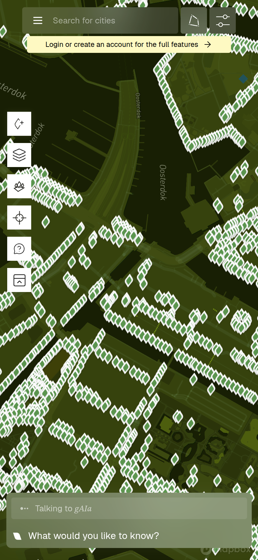
gAIa is a living map of real city trees. You can explore trees around you, see how they grow, and even talk to them. When you first open the app, you land on the map — so let's decode the buttons you'll see there.
The top bar
Across the top of the screen you'll find four controls:
 Menu — opens your personal lists: Favourite Trees, Added Trees, Previous Chats, and Settings.
🔍 Search — jump to a city or area. gAIa currently has trees in Amsterdam, London, and Stuttgart.
 Mini-forest — draw an area on the map to group nearby trees into a "mini-forest" you can study and talk to as one community. The button turns orange while you're drawing.
 Filters — narrow down which trees appear: by species, height, or year planted. A small number badge shows how many filters are active.
The side toolbar
Down the left edge sits a vertical strip of map tools. The first two are always visible; a small down-arrow expander at the bottom reveals the rest:
 Add a tree — place a new tree on the map and fill in its details, so the community map keeps growing.
 Map style — switch the map's backdrop between gAIa's default green style and street or satellite views.
 Individual / cluster view — toggle between seeing every individual tree and trees grouped into clusters (handy when you zoom out over a neighbourhood or want population-level figures).
 My location — recentre the map on where you are right now.
 Help & feedback — find guides like this one, or send us a bug report or suggestion.
A few actions — adding a tree, opening filters, drawing a mini-forest, or viewing your lists — will ask you to sign in first. It's free, and it lets gAIa save your trees and conversations.
What's next
Now you can find your way around. In Part 2: Reading a Tree's Details Panel, we'll tap on a tree and read everything its details panel has to offer.